
Powerful Solutions for Global ISR Teams
Space powered SIGINT, ELINT & MDA as a service.
Use Cases
Real life applications
Enhance your ISR programs with increased visibility of risks, on-ground activities, and persistent monitoring of RF emitters.
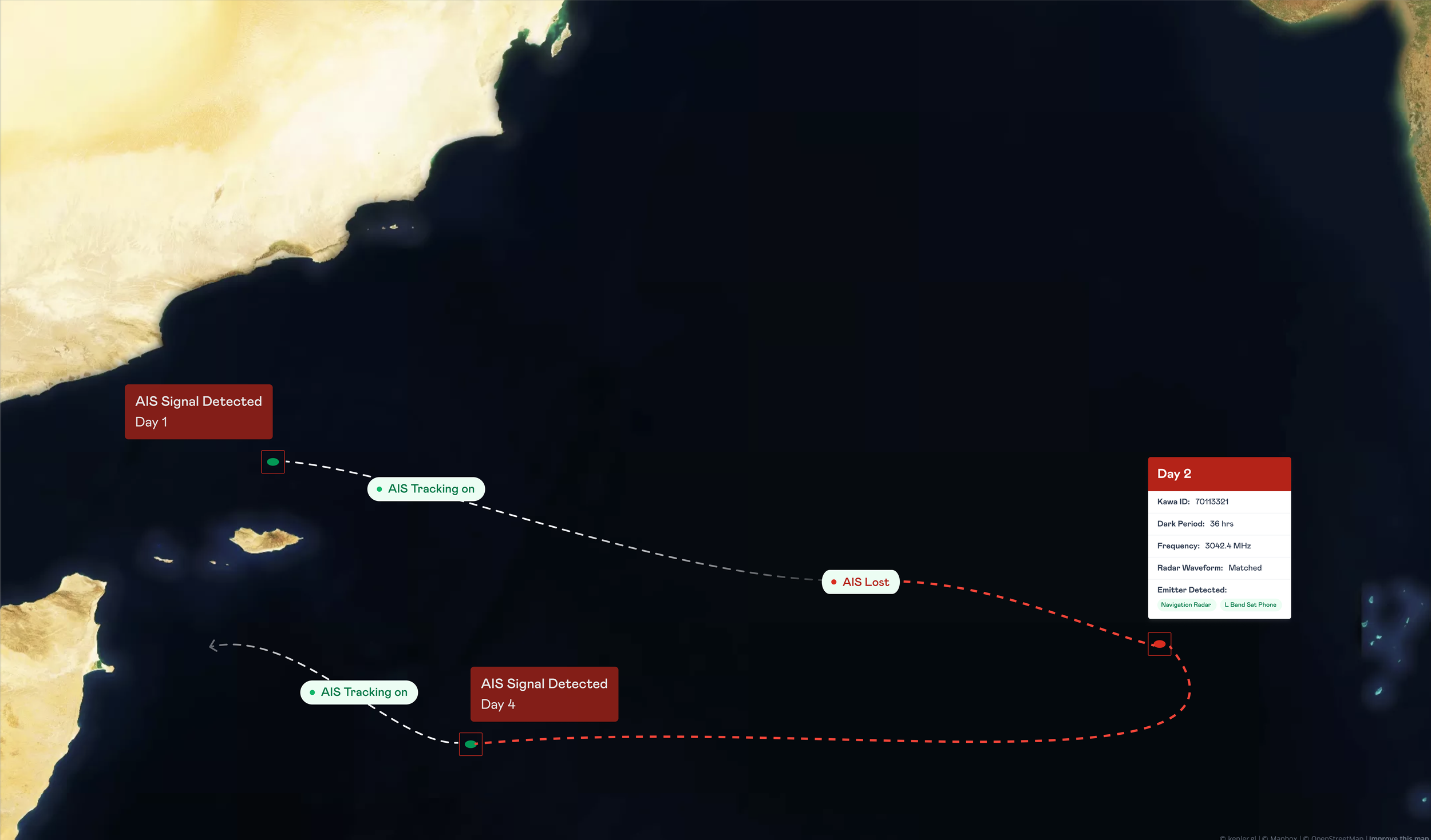
Identify and track vessel activity anywhere in the world.
S & X full band scan and correlation with AIS Data.
Geolocate and track dark vessels using our ML/AI models.
Powerful MDA software to explore the full profile of vessels of interest.
Maritime Domain Awareness


Improve area domain awareness by tracking & localising anomalous behaviour
Detect land-based emitters.
Locate L band phones, telecom deployment and other communication infra.
Global coverage with near-real-time revisit.
Tuneable frequency on-demand using Kawa OS.
Land-Based Applications


RF GEOINT as a service.
Technology
18 satellites are consistently collecting radio frequency signals upto 18GHz.
Data Collection
We process the signals and geolocate emitters using TDOA, TOA and FDOA.
Processing
Longitude, Latitude, Time and Relevant emitter data points are shared in a JSON format using API or Kawa Studio Platform.
Delivery

Accessible and Usable Geointelligence Data
Kawa Studio
A unified command centre to operate, manage and derive Signal and Geospatial Intelligence for your AOI.

-

Custom Tasking and Data Fusion
Task RF, Multispectral and SAR satellites on Demand. Fuse RF data with Multispectral and SAR imagery to gather faster intel.
-

RF Native
Request IQ data with a click of a button
-

Made For Teams
Custom dashboard to manage tasked orders and users collaborative environment to download and share findings with your team.